You are probably aware that you can create your own gauges and record your own climate logs to get the most localized data from your own weather stations and measurement devices. That absolutely helps you with your microclimate on your property, but what about the big picture? Good news! Farmbrite comes preloaded with data for you to review and gain insight from. These are shown under Satellite Maps and Weather History within the Climate section.
Be aware that not all data is available for all locations on all dates. While we strive to be complete with these, the data is dependent on third party sources (NOAA, NASA) and sometimes it is delayed or unavailable.
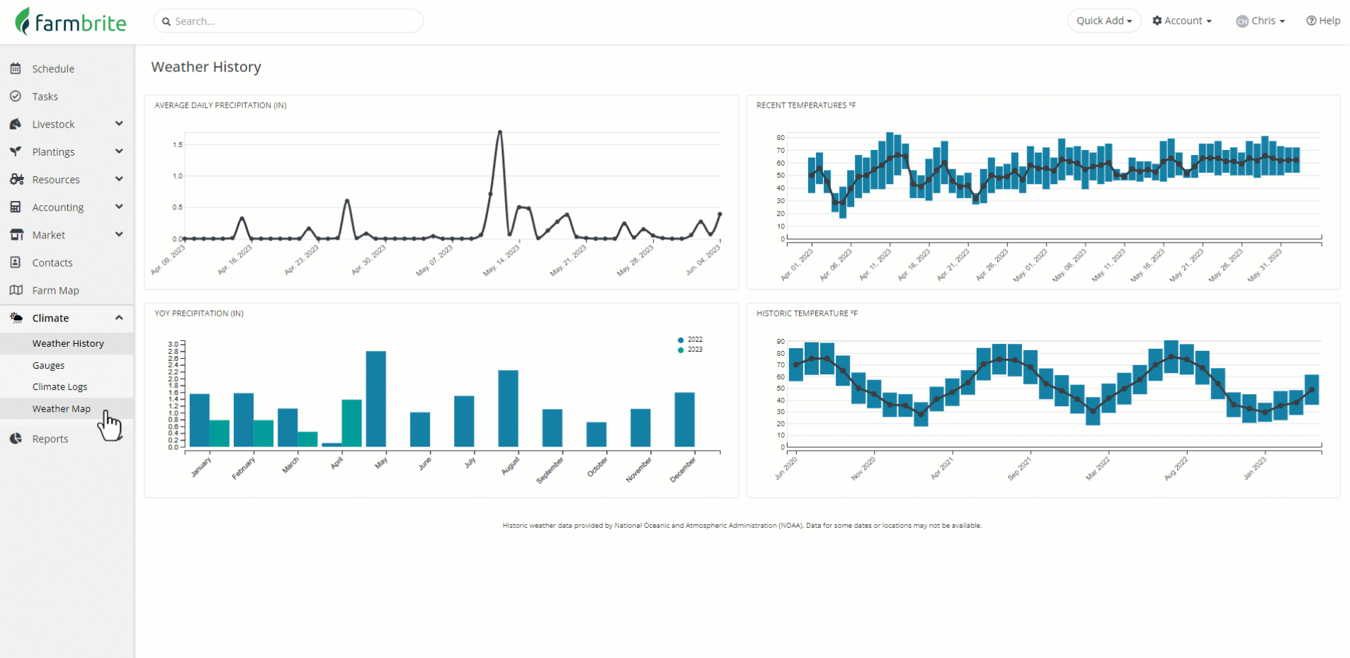
Let's take a look at the Weather History tab first. You'll be presented with four charts here.
- Average Daily Precipitation
- Recent Temperatures
- Year over Year Precipitation
- Historic Temperatures
These easy to access charts display the most relevant and critical information at a glace, as soon as you get to the Climate section. Check out how much wetter this April was compared to last year; we got 10x the moisture! What impact might that have on our starts and seedlings, and how can we be sure we are prepared to deal with it?
The Satellite Maps tab is a bit more in depth, with dozens of overlays for all kinds of important and interesting data. While the weather station in your southwest paddock provides excellent localized data, sometimes you might want to harness the power of NASA and NOAA satellites and zoom out for a more expansive view. From this page, you can select map overlays for temperatures, vegetation, soil moisture, precipitation, and more. This data is sourced from various sites; check out NLDAS, MODIS, and Noah LSM for more information on them. You'll see where each is sourced when selecting the map overlay in the dropdown menu.