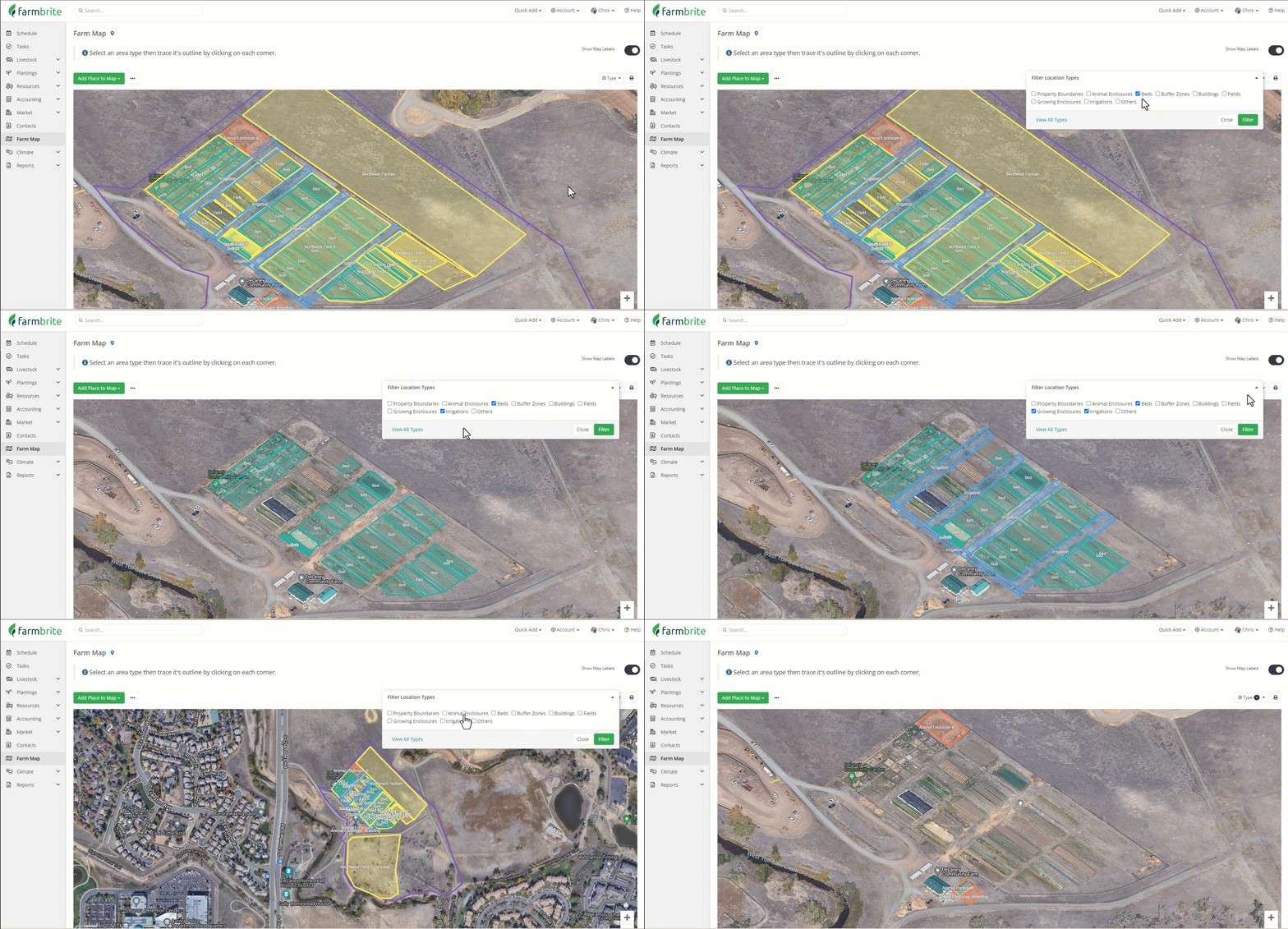
If you run a large operation you likely have many fields, beds, buildings, enclosures, and a lot more on your farm map. Having the comprehensive overview with everything is very useful, but maybe you'd also like to filter the map by specific location types. Perhaps you'd like to see your buildings and property boundary, or you need to see just your animal enclosures.
To do this, you'll first navigate to your Farm Map from the menu on the left. Then, click the Type filter in the upper right, and select what type of items you'd like to display on the map. You can choose as many or as few as you'd like. Click apply and the map will reload with only the selected location types.
You can also click "View All Types" to reload again and see all of your location types.

The farm map overall can help give you a birds-eye view of your property. You might use this feature to help you find efficiencies in your farm operations.
- Set the filter to show your property boundary, and then add the other types in one by one to see where you might add additional fields and beds, or where you might be able to reorganize your layout.
- Filter for just your irrigation lines to see where you might be sending water that can be used for additional beds.
- Are your animal enclosures optimized? Perhaps you could move them closer to your irrigation or grazing fields to make it easier to move them. Or, maybe you'll make changes based on proximity to your feeders and grain storage silos.
- Set the filter to only show buffer zones. Do you have enough space between your fields and your neighbors?
- Have you missed connecting any of your fields, bed, and grow enclosures to your growing locations? When you make these connections you'll have shortcuts on your grow location records to access the map directly from there.
- Zoom out far and be sure you have not placed any additional fields outside of your property.